


/ Blog

July 14, 2022
Where A City Began: A Brief History of North East Winnipeg
From Manitoba’s entrance into Confederation in 1870, the north east area of Winnipeg has evolved from a rural farming municipality to an urban industrial, commercial and residential space in the city. With that said, the settled history of North East Winnipeg, consisting of Elmwood, East Kildonan, and North Kildonan, stretches back much further than people may realize today. Not only is it one of the earliest settled areas in Winnipeg, but in Manitoba, dating back to the 1820s. As a result, North East Winnipeg’s history shares a glimpse into the modernization and urban expansion of the city we know today.
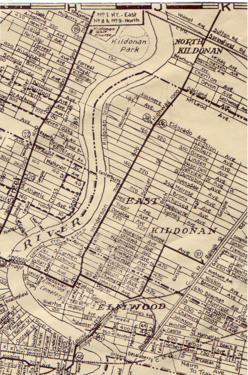
Map of North East Winnipeg, East Kildonan 1930.
Source: Jim Smith for the North East Winnipeg Historical Society Inc.
Long seen as just a woodlot area for Selkirk Settlers residing on the west banks of the Red River, the north east area of Winnipeg has developed its history rather early on compared to other parts of the city. For example, one of the area’s earliest settlers was a man named John Pritchard. Pritchard was first involved in the fur trade before becoming a farmer in Winnipeg prior to the arrival of the Selkirk Settlers in 1812. His farm was the first farm established in North East Winnipeg, stretching from the Red River to what is now De Vries Avenue. Today, Pritchard’s original plot of land is occupied by the kindergarten to grade eight John Pritchard School.
Along with being one of the North East Winnipeg’s first settlers, John Pritchard established the first school in the area. Located on his property, “The Elms” school opened its doors in 1833 for children living nearby. It was a small school with only six students reported to be attending in the 1843 Red River census. Pritchard was given 25 pounds a year to maintain the school by the Hudson’s Bay Company. The school would operate on his property through these funds until the early 1850s when Pritchard’s son Samuel moved the school to what is now the Rural Municipality of West St. Paul.
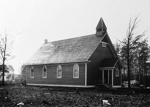
John Black Memorial Church at 898 Henderson Highway in East Kildonan, seen here in the 1920s, still serves the community of North East Winnipeg today.
Source: Jim Smith
In the years following the establishment of “The Elms” school, the population of the North East was fairly stagnant. For example, in 1835, the Red River census recorded only 7 families and 38 people in total, living on the narrow farm lots of the area. These river lots stretched back from the river for two miles and are still designated as part of the legal definition of property in Winnipeg today. It was not until Manitoba entered into Confederation in 1870 that the number of families living in the north east part of the city would increase to 44 families with a total population of around 350 people. This population increase between 1835 and 1870 made the construction of a watermill to grind grain into flour possible. Located on Angus Matheson‘s farm, known today off of McLeod Creek, the Matheson grain mill created job opportunities and industrial interest for the area. Two of the original flour millstones are located in a small park off Henderson Highway and Edison Avenue and can be still seen today.
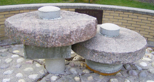
The Matheson Millstones at Edison Avenue and Henderson Highway.
Source: Jim Smith
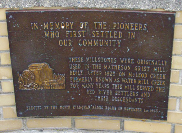
The plaque with the Matheson Millstones at Edison Avenue and Henderson Highway.
Source: Jim Smith
The first public school in North East Winnipeg was located on a three-quarters acre of land on the west side of Henderson Highway, north of what is presently Rowandale Avenue. Established in 1871, Kildonan East School was a one-room log cabin that cost just under $800 to build and furnish, including purchasing the land. Kildonan East was part of the Protestant School Division, however, it was open to students of all denominations to enroll. From its initial opening, the one-room school taught 59 students from grades one through five. By 1876, the school’s enrollment reached 93 students with the addition of a grade six class. Even with the impressive one-year increase in enrollment, students’ attendance varied as there was no legal requirement for children to attend school until 1915. Kildonan East School taught classes that included reading, writing, geography, history, and spelling to name a few. After Kildonan East students finished grade six, they would have to travel outside of their neighbourhood or study by correspondence. In addition to being the only public school in the area, Kildonan East School was used for board meetings, public meetings, concerts, and elections. Over the years Kildonan East was joined by other schools in the area. As a result, the outdated, small and obscure location of Kildonan East School contributed to its decline. By 1908, Kildonan East School was officially closed, and the building was torn down.
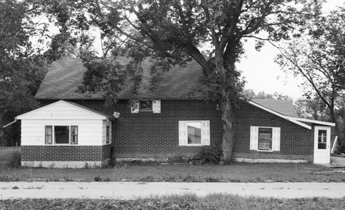
The 1854 Henderson House, seen here in 1978, was once located at 2112 Henderson Highway in North Kildonan. Once a pristine example of Red River frame architecture and one of the oldest houses in Winnipeg, it was relocated to St. Norbert Provincial Heritage Park.
Source: Jim Smith
One might think that settlement of the area first spread from the south in Elmwood to the north in North Kildonan, however, that is not true. Settlement of North East Winnipeg began with farms in what is now North Kildonan. Following the settlement of the north, residents expanded to East Kildonan and finally Elmwood. At the time of the last Red River census of 1870, only one family was settled on a farm located in the Elmwood area. This was due to the elevation of the land in relation to the Red River. Much of Elmwood’s land is low-lying, swampy, and subject to frequent flooding, especially near the river. This made it exceptionally difficult for farmers to successful yield crops from the area. During this time, the Seine River ran further north through Elmwood into the Glen Elm area of the Red River. Due to further development of the area, the Seine River was diverted, flowing into the Red at St. Boniface, however, the remains of the original Seine River waterway can still be seen today along Henderson Highway near Chalmers Avenue.
The first municipal government of North East Winnipeg was the creation of the Municipality of Kildonan-St. John in 1875, which was changed to the Municipality of Kildonan a year later. The municipality covered both sides of the Red River – on the west side, from Burrows Avenue in the south, to four miles west of the river, to the northern Winnipeg border. On the east side of the Red River, the municipality stretched from what is now the southern part of the Elmwood Cemetery, north to the current Winnipeg – East St. Paul border. On the west side of the river, the Municipality of Kildonan shrank as the City of Winnipeg moved northward from the 1870s to 1914. On the east, the Municipality of Kildonan expanded its reach southward in 1896, as the municipality took in the northern part of St. Boniface. Most residents were predominately English-speaking, and therefore unhappy with being part of a largely French-speaking town. Moreover, the northern part of St. Boniface had poor road access to the rest of St. Boniface which made transportation difficult. This amalgamation part of St. Boniface in the Municipality of Kildonan can still be seen today in the french street names in parts of Elmwood.
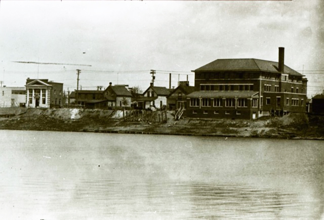
Located in Elmwood, the 1914 LaSalle Hotel and Nairn Avenue are seen from the Red River in 1917.
Source: Jim Smith
After 1869, the area of Elmwood around the Louise Bridge became the first part of North East Winnipeg to be settled intensively by industrial companies, general businesses, and homes. The area was commonly known as the Louise Bridge District or Kildonan Village. The name “Elmwood” did not come into use until the Elmwood Cemetery opened in 1902. As the population of Elmwood expanded, residents of the area began to demand more services from the Municipality of Kildonan. The municipality was unwilling to provide more urban amenities as it wished to remain a rural municipality. As a result, Elmwood residents approached the City of Winnipeg to take in their neighbourhood as part of the Greater Winnipeg Municipality in 1905. A year later, Elmwood was officially considered part of the City of Winnipeg, particularly the area of Harbison Avenue to the St. Boniface boundary.
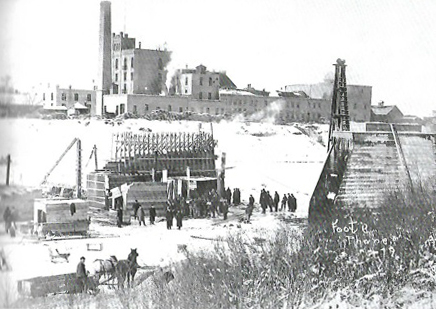
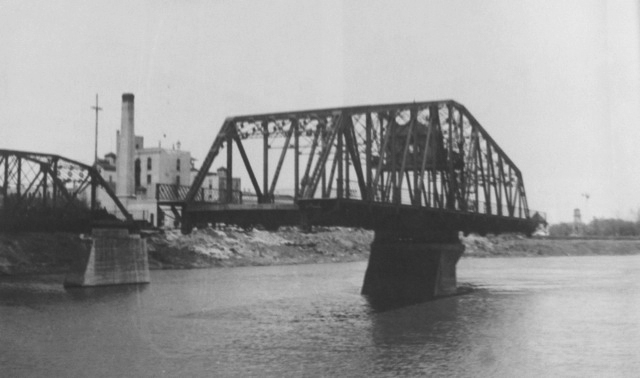
The Redwood Bridge, which connects Elmwood to the west side of the Red River, under construction in 1906.
Source: Jim Smith
The Redwood Bridge in the open position in 1958.
Source: Jim Smith
In 1914, residents living on the east side of the Red River, north of Harbison Avenue decided that they too wanted to break off from the rural Municipality of Kildonan. This was mostly due to their concerns about being dominated by the residents living on the west side with whom they had few ties. As a result, the Municipality of East Kildonan was formed in 1914. The only transportation connection between the two sides of the river was a ferry that was located on the east side at Whellams Lane. The ferry was not a reliable source of transportation, as it was merely a raft-like boat that was pulled by cables across the river and back. However, it was established in the late 1870s and remained in service until 1919, despite its unstable structure.
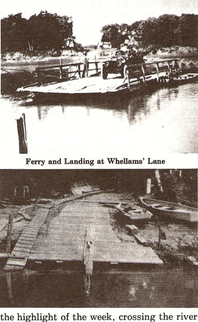
The Kildonan Ferry at Whellams Lane.
Source: Jim Smith
After 1914, East Kildonan began changing as more people moved in, especially in the southern part along Henderson Highway. With more homes popping up in the area, demands grew to accommodate urban developmental needs such as paved streets, sidewalks, water mains, and sewers. These demands were granted for the most part but as this urbanization occurred higher taxes were to be expected. With that said, the people living further away from the urban centre resented paying higher taxes for their improvements and in 1924 petitioned to split off from East Kildonan. The split worked and the Municipality of North Kildonan was created in 1925.
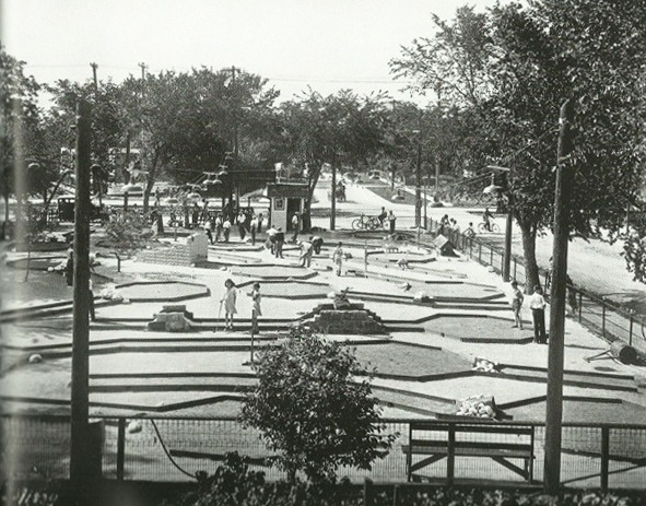
Bob O Links miniature golf, southeast corner of Henderson Highway and Hazel Dell Avenue in East Kildonan in 1930.
Source: Jim Smith
During the 1910s and 1920s, Elmwood and East Kildonan increased their populations significantly, however, this growth came to almost a complete stop in the 1930s. In East Kildonan, the Depression caused the municipality to declare bankruptcy in 1933, as an extremely high number of residents were unable to pay their property taxes and 38% of families were dependent on welfare. As a result, East Kildonan’s finances were put under the control of the Municipal Public Utility Board and remained under its control until 1952. North Kildonan suffered less than its neighbours. It had much lower debt due to its large proportion of the population living off the land.
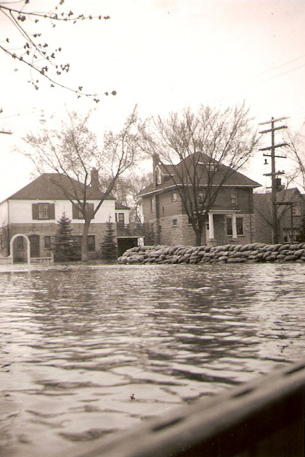
The south end of Glenwood Crescent in Elmwood during the 1950 Flood.
Source: Jim Smith
By the late 1940s, Elmwood saw more and more houses being built and continued well into the 1960s when most of the area’s vacant lots had filled up. Similarly, East Kildonan’s population rose between the 1940s and 1960s, almost tripling in size. This population growth resulted in East Kildonan becoming a city on July 1, 1957. From then, it would remain its own city until the arrival of Unicity and the amalgamation of the surrounding, cities, towns, and municipalities into the larger city of Winnipeg in 1972. East Kildonan, along with the City of Winnipeg, were the only municipalities in favour of this plan. North Kildonan however, experienced a slower population growth, which came later than both Elmwood and East Kildonan, only really beginning in the late 1950s, then into the 1960s, 1970s, and 1980s.
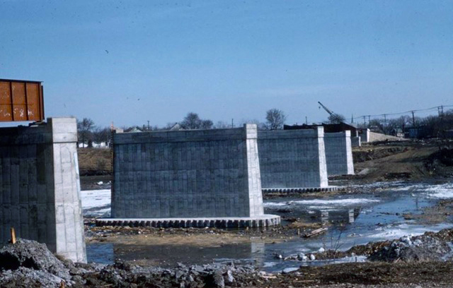
The Disraeli Bridge, seen here under construction in 1959, connected Elmwood with downtown Winnipeg.
Source: Jim Smith
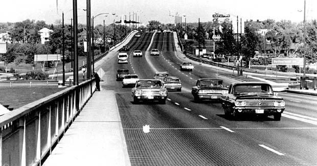
Disraeli Bridge and Freeway on September 30, 1970.
Source: Jim Smith
Today the area that once was part of the original Municipality of Kildonan has about 95,000 residents. With how the City of Winnipeg has expanded, one would never know that the North East used to be its own separate municipality! The history of the North East of Winnipeg gives a glimpse into the mosaic that currently makes up the city. Not only was the North East of Winnipeg its own municipality, but it also has its own growth that is unique. Today, the North East continues to be a mix of residential and industrial spaces, adapting to serve a diverse and modern community.
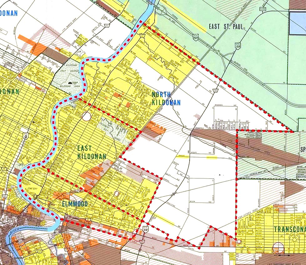
A 1969 map of Elmwood, East Kildonan and North Kildonan.
Source: North East Winnipeg Historical Society
THANK YOU TO THE SPONSOR OF THIS BLOG POST:
Guest blog written by Jim Smith.
Edited by Heritage Winnipeg.