


/ News

November 3, 2025
A Map of Winnipeg’s Past
Heritage Winnipeg would like to thank Dan Saidman for his generous donation of an antique City of Winnipeg atlas to our organization. The large leatherbound book, which appears to be from around 1906, contains hand-drawn maps showing early neighbourhoods, street grids, and notable civic landmarks. We are honoured to be entrusted as the stewards of this important historical document that provides rich insight into the development of our city.
The atlas, which Saidman found in the basement of his family home, likely belonged to one of his forebears. His grandfather was Ukrainian born Sam Saidman, a pharmacist by trade who established the Sam the Camera Man photography store in Winnipeg in 1955. Nearing retirement, Sam then started the the Woodrow Fine Arts Collection, filling every inch of his home and gallery space with paintings. A great lover of art, his eccentric assortment included everything from restikes of works by famous artists such as Pierre-Auguste Renoir, Édouard Manet and Francisco Goya to students creations from the University of Manitoba School of Art. But the heart of the collection was the paintings of Jean Eyden, who happened to be Sam’s mother-in-law. Over 200 pieces from the collection were sold as a fundraiser for Augustine United Church in 1986 after Sam passed away on February 3rd, 1985, in Winnipeg
The atlas could have also belonged to Eyden, who was born in Lancashire, England in 1889, and enjoyed drawing since childhood. She overcame disability and illness to study at the Liverpool School of Art before moving to Winnipeg in 1921. There she joined the Winnipeg Sketch Club in 1925 and continued studying under renowned artists, becoming a full member of the Manitoba Society of Artists in 1943. With docks and boats being her favourite subject, Eyden successfully exhibited her art across Canada, showcasing her talent with watercolours. Eyden passed away on February 26th, 1990, in Winnipeg.
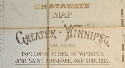
The maps in the atlas are the work of the McPhillips Brothers. The McPhillips Brothers was a firm of Dominion Land Surveyors (DLS), civil engineers, and draughtsmen; prominent in Winnipeg around the turn of the 20th century. George McPhillips Sr. was an DLS and civil engineer who traveled west to Manitoba for work around 1870, bringing two of his five sons, Francis McPhillips and Robert Charles McPhillips, along with him to assist in surveying. A third son, George McPhillips Jr., joined the Manitoba group later in 1972. George Jr. went on to become a qualified DLS and civil engineer, hired by the City of Winnipeg in 1875 to survey the young city and its surroundings. Challenging but lucrative, over 460 kilometers of streets were surveyed for the City of Winnipeg project. The result was the first official map of Winnipeg – also the first map of its kind in Western Canada. Wildly success, the project created a great demand for George Jr.’s work.
After George Sr. retired, the three aforementioned sons, headed up by George Jr., opened their own firm in 1881. Called the McPhillips Brothers, they operated out of the Biggs Block at 469 Main Street. Along with mapping southern Manitoba, the McPhillips Brothers continued updating George Jr.’s City of Winnipeg map and marketed it to the public until about 1914. George Jr. pursued various new mapping opportunities including spending a year as a surveyor for the City of Winnipeg in 1882, before leaving family firm in 1906 to become the chief surveyor for the Canadian Pacific Railway. Francis and Robert stayed on with the McPhillips Brothers firm. All three brother eventually passed away in Winnipeg, with Francis and George Jr. dying in 1913 while Robert, making maps right up until the end, died in 1939.
The maps made by George Jr. and his brothers shaped the City of Winnipeg that we see today – McPhillips Street was even named after the family! Though it is unclear exactly how the street got its name or which family member it refers to. Some say the street was named after Francis, while others suggest the City of Winnipeg name it as a thanks to George Jr. for his invaluable surveying work. The first map of Winnipeg would have been absolutely essential for planning the development of the city and its surroundings, used by everyone from city planners to railway companies. Other have said that George Jr. named McPhillips Street himself after the family as a whole, back when he was first mapping the city and it was a mere road allowance. Flora Avenue was also supposedly named by George Jr., after his wife, Flora Ella Caron.
We sincerely thank Dan for his thoughtful donation and for helping preserve a remarkable piece of Winnipeg’s history!
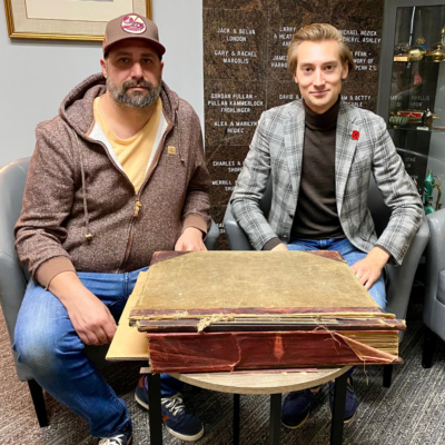
Dan Saidman (left) and Kenneth Ingram (President of Seven Oaks Historical Society and Heritage Winnipeg board member) with the atlas donated to Heritage Winnipeg.
Source: Kenneth Ingram (used with permission)
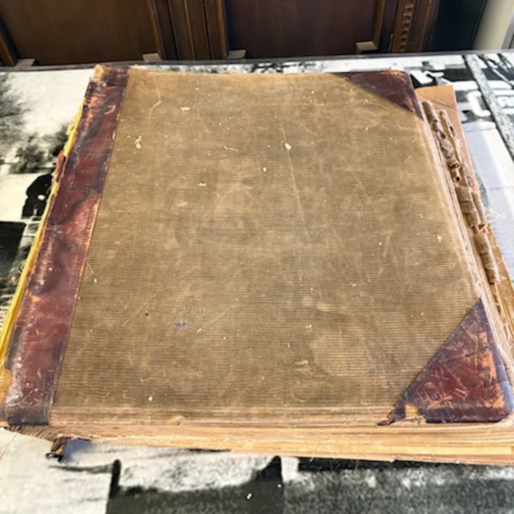
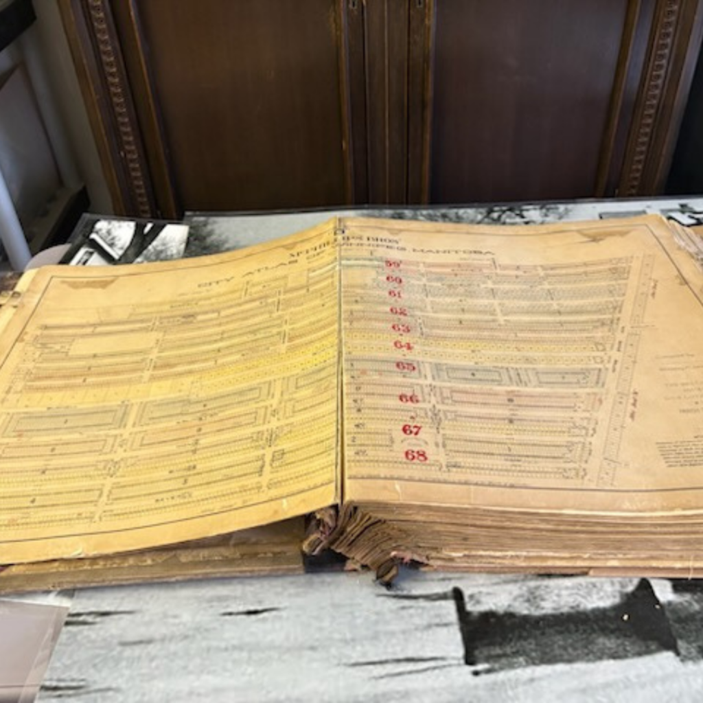
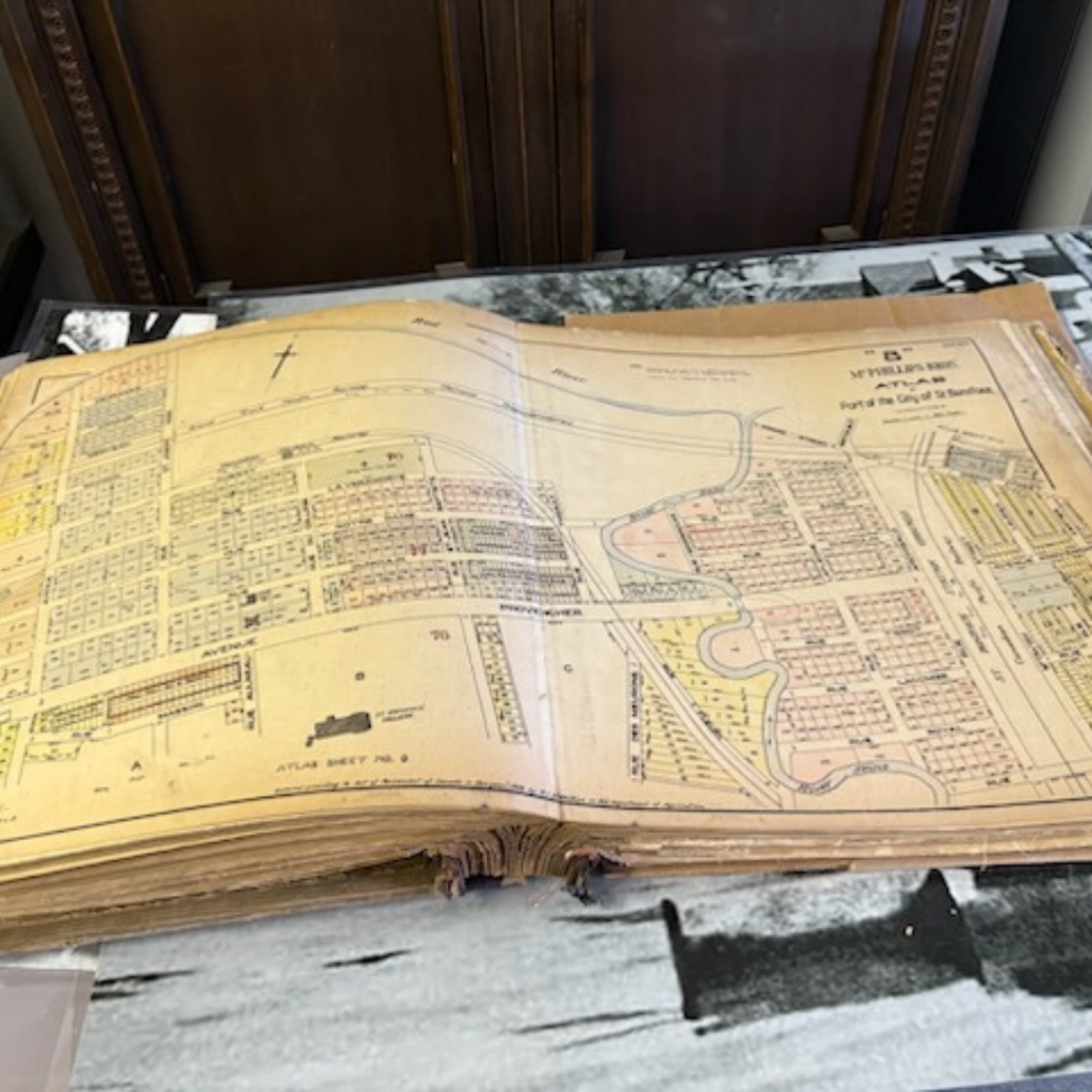
Source: Heritage Winnipeg